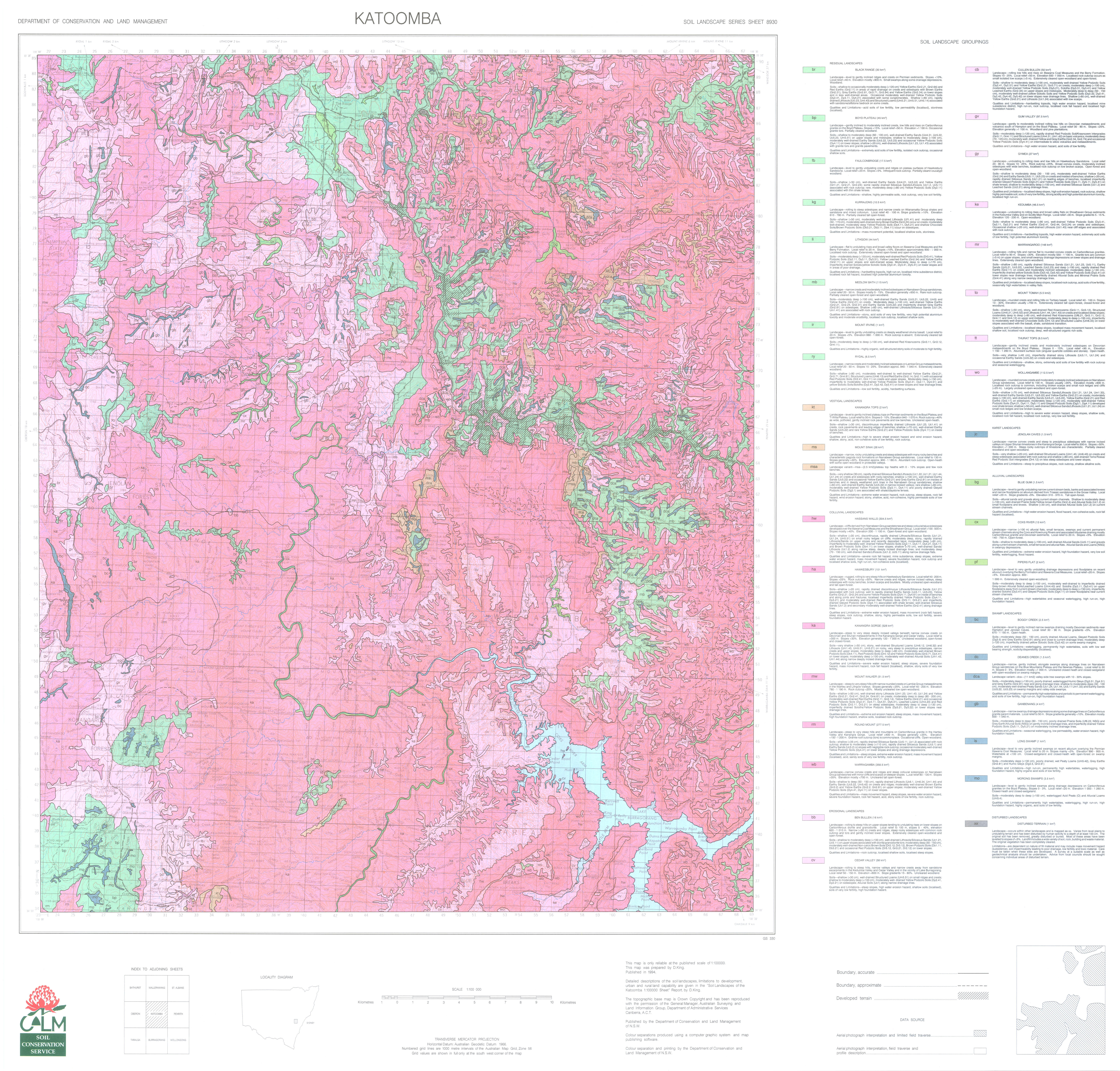
  • Log in
data.gov.au Data.gov.au
  • Datasets
  • Organisations
  • About
  1. Home
  2. Organisations
  3. NSW Department of Climate...
  4. Soil Landscapes of the...
  5. Soil landscape map

Soil landscape map

Soil Landscapes of the Katoomba 1:100,000 Sheet

Created 06/06/2025

Updated 06/06/2025

  • Download

Source

This data file or API can be downloaded from:

https://datasets.seed.nsw.gov.au/dataset/c69abd91-c39d-4e89-a07a-09b64ed9545d/resource/73936bd3-edda-4f64-99ca-9aa1e10fd193/download/katoomba8930ed1soillandscapesmap.jpg

Resources

  • Data quality statement
  • Show on eSPADE Web Map
  • Soil landscape data package
  • GIS data
  • Soil landscape reports
  • Soil landscape map
  • NSW Government Online Shop
  • Soil map information
  • Land and soil information
  • Image
Fullscreen Embed

Embed resource view

You can copy and paste the embed code into a CMS or blog software that supports raw HTML

Additional Information

Field Value
Data last updated unknown
Metadata last updated June 6, 2025
Format JPG
License Creative Commons Attribution 3.0 Australia
Datastore activeFalse
Datastore contains all records of source fileFalse
Has viewsTrue
Id99f073c9-3f21-478f-9477-c78685161fe0
Mimetypeimage/jpeg
Package id80070704-d819-46d7-8aac-ccd6b584943a
Position5
Stateactive
Zip extractFalse
Size Unknown
ID 99f073c9-3f21-478f-9477-c78685161fe0
Harvested True
Package ID 80070704-d819-46d7-8aac-ccd6b584943a
State active
Data.gov.au
  • About Us
  • Privacy Policy
  • Recent Developments
  • Give feedback
  • Contact us
Publishers
  • Login
  • User Guide
Developers
  • API Documentation
  • CKAN Documentation
  • Disclaimers
  • Contact
  • Demo Menu

© Commonwealth of Australia. With the exception of the Commonwealth Coat of Arms and where otherwise noted, this work is licensed under the CC BY 4.0 license.