Woodlawn Mine Gravity Surveys (P200621), gravity point data
ARCHIVED
Created 20/01/2025
Updated 20/01/2025
Files and APIs
-
URLFile available for download in various formats from the GADDS2 portalLicense Not Specified
-
application/x-netcdfWoodlawn Mine Gravity Surveys (P200621), gravity point data file downloadLicense Not Specified
-
HTMLWoodlawn Mine Gravity Surveys (P200621), gravity point data OPeNDAPLicense Not Specified
Tags
Additional Info
| Field | Value |
|---|---|
| Title | Woodlawn Mine Gravity Surveys (P200621), gravity point data |
| Language | eng |
| Licence | Not Specified |
| Landing Page | https://devweb.dga.links.com.au/data/dataset/88de3569-deb4-40b9-9abf-22ddb057652b |
| Contact Point | |
| Reference Period | 01/01/2006 - 31/12/2006 |
| Geospatial Coverage |
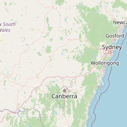 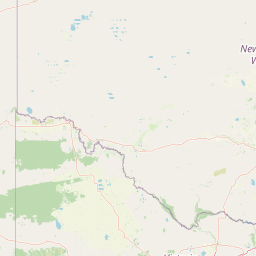  Map data © OpenStreetMap contributors
{
  "coordinates": [
    [
      [
        149.4763,
        -35.1766
      ],
      [
        149.6736,
        -35.1766
      ],
      [
        149.6736,
        -34.9845
      ],
      [
        149.4763,
        -34.9845
      ],
      [
        149.4763,
        -35.1766
      ]
    ]
  ],
  "type": "Polygon"
}
|
| Data Portal | Data.gov.au |