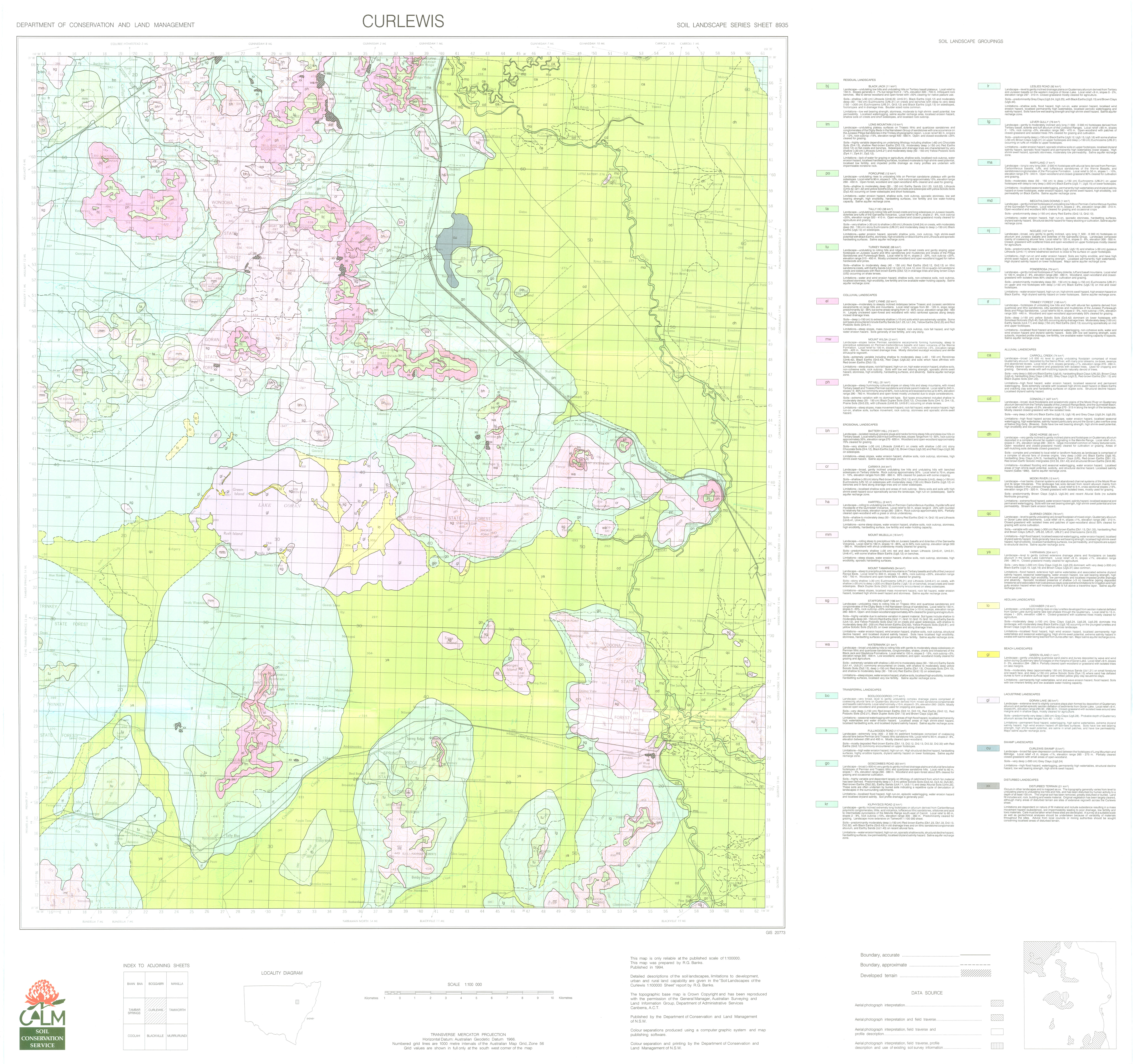
  • Log in
  • Register
data.gov.au Data.gov.au
  • Datasets
  • Organisations
  • About
  1. Home
  2. Organisations
  3. NSW Department of Climate...
  4. Soil Landscapes of the...
  5. Soil landscape map

Soil landscape map

Soil Landscapes of the Curlewis 1:100,000 Sheet

Created 05/05/2025

Updated 05/05/2025

    • CSV
    • TSV
    • JSON
    • XML

Source

This data file or API can be downloaded from:

https://datasets.seed.nsw.gov.au/dataset/1fc4eca3-f68c-40ce-87d0-d67915384f2c/resource/8210d114-6664-47b8-a719-e06891a93ca5/download/curlewis8935ed1soillandscapemap.jpg

Resources

  • Data quality statement
  • Show on eSPADE Web Map
  • NSW Government Online Shop
  • Soil map information
  • Land and soil information
  • GIS data
  • Soil landscape map
  • Soil landscape reports
  • Soil landscape data package
  • Image
Fullscreen Embed

Embed resource view

You can copy and paste the embed code into a CMS or blog software that supports raw HTML

Additional Information

Field Value
Data last updated unknown
Metadata last updated May 5, 2025
Format JPEG
License Creative Commons Attribution 3.0 Australia
Datastore activeFalse
Datastore contains all records of source fileFalse
Has viewsTrue
Idd1d1be1f-e0aa-4ba4-9627-b9b9c6d002a3
Mimetypeimage/jpeg
Package id3245b8df-996b-4fa0-9cee-e1646e40a679
Position6
Stateactive
Zip extractFalse
Size Unknown
ID d1d1be1f-e0aa-4ba4-9627-b9b9c6d002a3
Harvested True
Package ID 3245b8df-996b-4fa0-9cee-e1646e40a679
State active
Data.gov.au
  • About Us
  • Privacy Policy
  • Recent Developments
  • Give feedback
  • Contact us
Publishers
  • Login
  • User Guide
Developers
  • API Documentation
  • CKAN Documentation
  • Accessibility
  • Copyright
  • Disclaimers
  • Contact
  • Demo Menu

© Commonwealth of Australia. With the exception of the Commonwealth Coat of Arms and where otherwise noted, this work is licensed under the CC BY 4.0 license.